Find Iowa County Property Records
Iowa County Property Records are built around Dodgeville, where the Register of Deeds office and land information pages give you a direct route to older land files, parcel maps, and current public searches. The county is a good fit for both quick lookups and older chain-of-title work because the digital images reach back to the early 1800s. That means a search can begin with a modern parcel and still reach into the county's oldest indexed material. If you need the shortest path, start with the county office pages and then use the state tools to cross-check what you find.
The county homepage at iowacountywi.gov is the top-level entry point for the register office, GIS page, and county departments. It is the best place to start when you want to move from a document search to a parcel or survey question without wandering outside county sources.
Iowa County Property Records Office
The Iowa County Register of Deeds office sits at 222 W. Elm Street in Dodgeville. It keeps real estate records and vital records, but it also sets a strict tone for searching. Copy requests must be made by 4:00 PM, and the office has a zero-tolerance policy for cell phones and other digital devices while searching. That may sound small, but it matters when you are working with older books or trying to keep a clean record trail. Iowa County Property Records are easier to trust when the office rules are clear.
The county office page at iowacountywi.gov/departments/RegisterofDeeds is the main starting point for the local search. The research says LandShark is the county's public access system, and it can take you into digital images that go back to the early 1800s. The grantor-grantee search goes back to the 1940s, legal description tracting starts in 1990, and survey plats and CSMs can be traced back to 1810. That makes Iowa County Property Records unusually deep for a county page, especially when the search turns historical.
See the Iowa County Register of Deeds page in this Iowa County Register of Deeds source before you request a copy or plan a search visit.
The state register of deeds image works as a broader Wisconsin reference while the county office handles the local file.
Iowa County Property Records Search
Iowa County gives users several search routes, and that is one reason the county is useful for serious record work. The county GIS page at iowacountywi.gov/gis connects land records search with real property listing, tax parcel maps, GIS layers, land surveys, and public land survey monument records. That means the search is not just about the image. It is also about the parcel and the survey line behind the image. In a county with older records, that extra structure matters a lot.
The county research also notes that Iowa County uses LandShark, Tapestry, and Laredo as its online document options. You can think of them as the access layer around the office records. LandShark is the main public-facing image path. Tapestry is the alternative search route. Laredo is the subscription option for users who work through records every day. Together, they give Iowa County Property Records a lot of flexibility without sending you to a county that is light on historical material.
The Wisconsin Department of Revenue transfer search at ww2.revenue.wi.gov/RETRWebPublic/application is the best state cross-check when a deed or transfer needs another look. It helps compare what was recorded in the county with what the state transfer return shows. That is useful when a parcel changed hands, when a legal description is old, or when you need to make sure the county and state records tell the same story.
See the Iowa County GIS page in this Iowa County GIS source when you need parcel maps, surveys, or monument records.
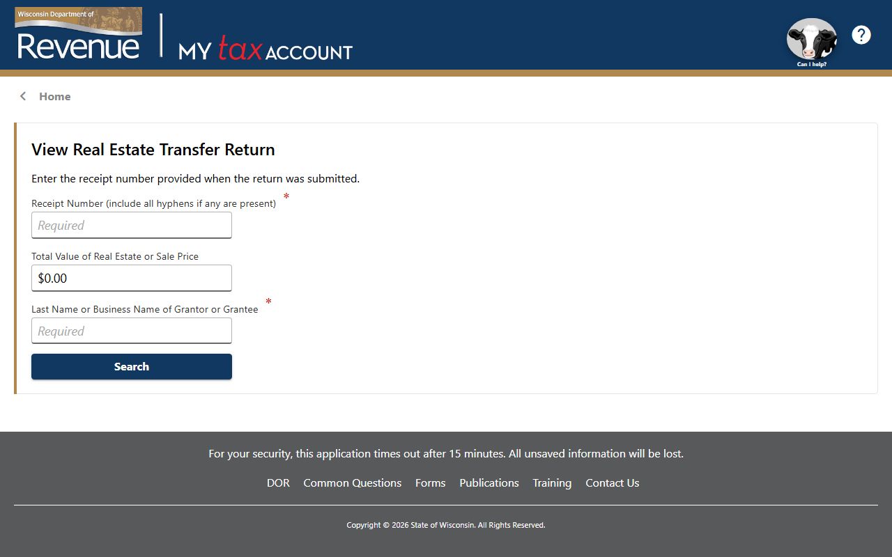
That state transfer search is the cleanest way to cross-check a county transfer file against the statewide return system.
Iowa County Property Records Maps
Iowa County Property Records work well with maps because the county land information office keeps real property listing data, tax parcel maps, GIS, land surveys, and public land survey monumentation records. That means a parcel can be checked from several angles at once. If a deed image gives you the legal side, the map layer gives you the physical side. That is the right balance for a county with older records and a long survey history. It also makes the search more local, because you are not forced to leave the county page just to confirm a parcel line.
The statewide parcel map at sco.wisc.edu/parcels/data gives you another map check when you want a broader Wisconsin comparison. The State Cartographer's Office is not a substitute for the county, but it is a strong backup when you want to compare boundaries or see how the county fits into a larger data set. That is especially helpful in Iowa County, where survey plats and CSMs go back far enough that a map check can save you from chasing the wrong tract.
See the statewide parcel map in this State Cartographer's Office parcel data source when you need a Wisconsin-wide map comparison.
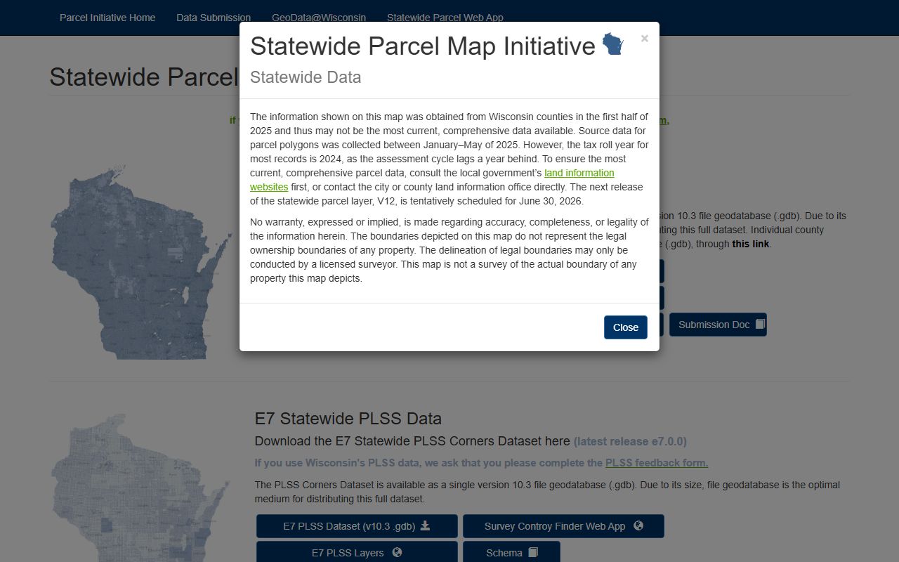
The statewide parcel layer is the best way to compare a county parcel with the larger Wisconsin map set.
Iowa County Property Records Fees
Even when the county page does not spell out every fee, the rule set still matters. The Wisconsin recording statute in Wis. Stat. 59.43 controls recording standards and basic register of deeds duties. The transfer fee rules in Wis. Stat. 77.22 and the exemption list in Wis. Stat. 77.25 shape what happens when land changes hands. The confidentiality rule in Wis. Stat. 77.265 also matters because transfer returns are not the same thing as the public deed file.
The county search rules themselves are strict. A copy request must be made by 4:00 PM, and the office does not allow cell phones or other digital devices while searching. That kind of rule is useful to know before you go, because it affects how the office handles a walk-in request. If you are working on an old land file, that office discipline can keep the search from going sideways. Iowa County Property Records are more efficient when you treat the office rules as part of the fee and access picture.
For broader state context, the Wisconsin State Law Library real property page at wilawlibrary.gov/topics/realprop.php is the best plain-language guide. It keeps forms, statutes, and property references in one place. That is useful when you are trying to decide whether a copy request, transfer fee question, or title issue belongs with the county office or with a state rule. The state page helps make the county page less abstract.
See the Wisconsin State Law Library real property guide in this Wisconsin State Law Library source when a county filing question turns into a statute question.

That image is a good fit for fee and rules questions because it points to the state framework behind the local file.
Iowa County Property Records Resources
Iowa County Property Records are stronger when you use the county GIS page, the Register of Deeds office, and the state resources together. The county land information office handles the real property listing and parcel map side. The register office handles the document side. Then LandShark, Tapestry, and Laredo fill in the access layer. That is enough to handle a modern parcel question or an older title search without losing the thread. It is also enough to keep the search local, which matters in a county with a deep historical record set.
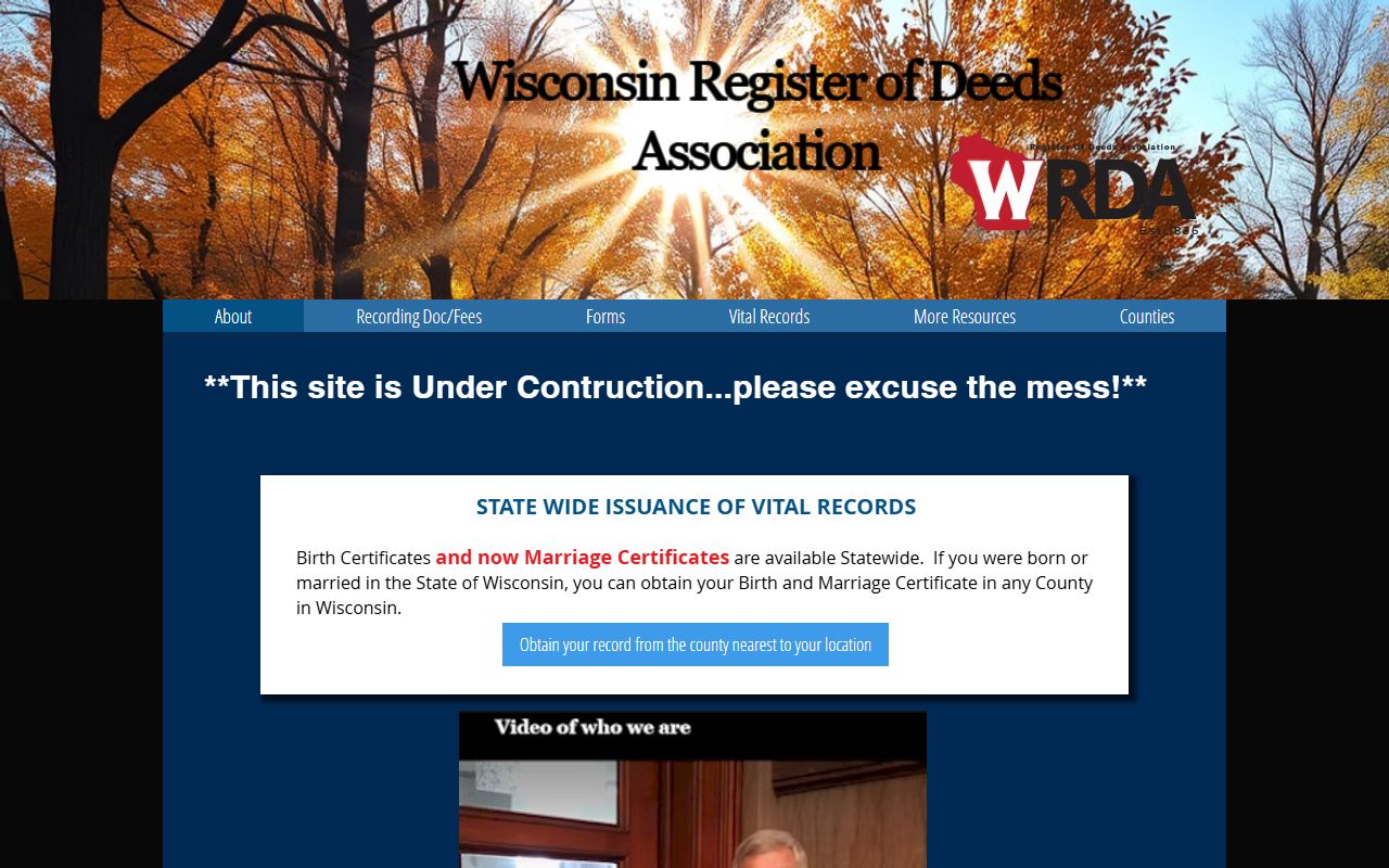
The Wisconsin Register of Deeds Association gives a statewide reference point for office practice and county contacts. The Department of Revenue transfer search and the State Cartographer's parcel data are the next two backup layers when the county file needs cross-checking. If you are tracing a 19th century image, a 1940s grantor-grantee lead, or a 1990 tract reference, those state pages help confirm that the county search is pointing in the right direction. That is the real value of Iowa County Property Records: the office gives depth, and the state gives context.
See the Wisconsin Register of Deeds Association in this WRDA source when you want a statewide county-records reference point.

The historical society image is useful here because older land work and genealogy often sit next to one another in Iowa County searches.
See the statewide parcel map data in this State Cartographer's Office source when you want to compare the county map with Wisconsin parcel data.
That parcel data layer is the final backup when the county parcel, survey, and ownership clues all need to line up.